| |
Main topics
- GIS and landscape archaeology: Case Studies
- GIS applications in archaeology: Methodological aspects
- Predictive modelling
- GIS and intra-site analysis
- Geoarchaeological studies
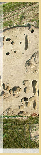
- Remote sensing: Geophysics, LIDAR, Satellite Images, GoogleEarth
- Field data retrieving, recording, documentation and investigation
- Web based spatial information systems, data storage and retrieval
- Web portals and the European Cultural and World Heritage: Education and Tourism
- Virtual museums and public archaeology applications
- Knowledge organization in large-scale databases
- Metadata, Ontologies and Semantics
- Long term preservation of digital data
- Digital Libraries and Collections Management
- Digital national monuments records
- Statistical mathematical analysis
- Economic approaches in archaeology using computer aided methods
- 3D Data capture and visualization
- Analytic tools to assist research on collections or artefacts
- Virtual reconstructions and visualization: Problems with uncertainty
- Augmented Reality and Interactive Environments and Applications
- Qualitative and quantitative analysis in 3D imaging – a matter of scale
- Archaeological theory and computers: Beyond the quantitative debate
- Asking questions – Setting standards: Possibilities and limitations of computer applications in archaeology
All other related topics are welcome!
Open Guidelines
Open Session Abstracts | Open Workshop Abstracts
Open Roundtable Abstracts
|
|